Being a Matatu Driver In Nairobi: An Interview with James Kariuki

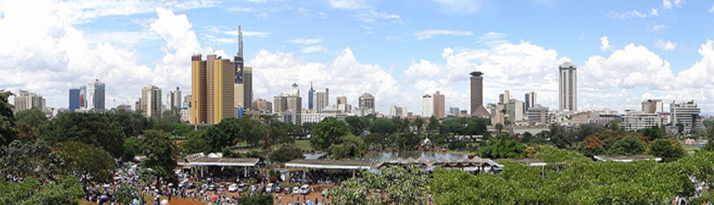
Nairobi Planning innovations had a chance to interview the experienced matatu driver James Kariuki who is also an avid blogger on matatu industry issues and the need for reform (See his blog at  http://wambururu.wordpress.com/). James is also a writer, an actor and a father who has been profiled as ‘the reluctant outlaw” by Al Jazeera. We asked him a few questions to get his views from inside the matatu industry.

images

NPI: How did you start in the matatu industry?

After dropping out of school in form 2 in the year 1992, I stayed at home for about two years. I later joined my mum at her food kiosk in Nairobi’s industry-area. This is how I interacted with matatus on a daily basis and I fell in love with the way the business was conducted. Around 1993, I became a conductor for a family van that used to ply between my village and a town in the outskirts of Nairobi called Dagoretti; a lot of people in the village worked at the slaughter house in that center and the demand for transport was very high. I got my license in 1997. By that time, I was already the driver of the family van as the cops did not insist on age or things like a PSV license. I moved to Ongata Rongai when my driver’s license attained the recommended 4 years; I became a fulltime matatu driver plying a city route in 2001.

NPI: What are the biggest difficulties you face in the industry?

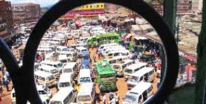
Bad driving is the most difficult thing that every matatu driver must learn to deal with. Although people are quick to blame matatus for all the bad things that happen on our roads, most of us have been behind the wheels for many years and have no accident record. Most of the times; and again because we are always present on the roads, we have to contend with very bad driving habits by other motorists. Many drivers carry permanent injuries as a result of accidents where they were not to blame. The second thing is working in a corruption zone where you can be victimized anytime. The absence of some form of employment contract for majority of workers in this industry exposes us to exploitation by different authorities including politicians. This opens the door to cartels including police officers and matatu owners who are harsh on matatu workers and who set very high targets making the job very difficult.

NPI:  What are the biggest pleasures? Is it sometimes fun?

The biggest pleasure is being able to pay the bills and raise a family and the opportunity to work and earn a living in a job where you are at different places at different times and interacting with different people every day. There is pleasure in serving and taking care of hundreds of peoples travel needs. It is fun to drive a brand new vehicle- especially a souped-up “Manyanga”. Of late we have seen very many new minibuses hitting the road; it is a mix of business and pleasure for those lucky drivers. Passengers love new vehicles and are willing to pay more and it is easy to meet the target and earn a good commission.

NPI: In your view, what are the three or four most important things we can do to fix congestion?

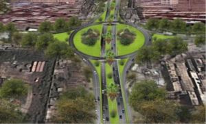
First we need to find a way of improving public transport services. We can do this if we make transport sustainable and dependable and build roads that will accommodate public service vehicle needs like bus stops, separate lanes/special lines and easy access to bus stations. The other thing would be to build enough parking spaces. Compare the cost of these interventions to the amount of time and fuel we waste every rush hour stuck in traffic The county governments can sure save taxpayers millions of shillings if they can afford to transform some of the spaces and buildings into parking. For instance, Kenya Railways occupies all the Land from Muthurwa all the way to Nairobi Railways Club on Ngong Road. The land extends to Mombasa Road near Nyayo stadium round about. On the Jogoo road side, there is Muthurwa bus park- but the access roads are poorly designed. If somehow the railways land would provide link roads for PSVs to get to the city and to bus stations, we can absorb all matatus coming from Mombasa road- Langata Road- Ngong Road- Enterprise Road and Jogoo Road. Come up with new training programs for drivers to educate them on driving skills and traffic regulations. Failure to observe traffic laws - over lapping- blocking exits/ entrances contribute to the congestion.

NPI: How about to improve safety?

Build infrastructures for all road users- bicycle lanes- pedestrians walks- secure bus stops-crossing bridges. At the current limited speed, we have seen fewer accidents injuries in matatu passengers but the number increased for non motorized road users. The way drivers are trained and how licenses are obtained is also a major contributor to road accidents. Seal all loopholes in the licensing departments and let every driver qualify for his/ her license.

NPI: You are a father-what do your children think of your work?

My kids’ think it’s the best job in the world;  They know that dad gets money everyday. They have known me doing what I do for all their lives. They don’t see me as a driver bimages-1ut rather a businessman, an actor and a writer. They have never had another lifestyle to compare with. They tell me to buy more matatus and employ drivers so that we can make more money.

NPI: How easy is it in your view for children to take a matatu by themselves? Do your children use a matatu regularly?

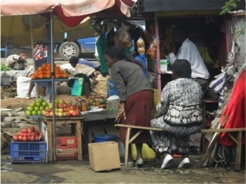
Matatus are probably the only affordable means/option for majority of people in Kenya to travel long and short distances. For the school going children who need to board matatus to and fro school, it’s not an easy task. Drivers ignore them because they rarely pay or pay little. Very small children forget their bus stops and end up lost or the crew taking them to police stations. Many matatu touts avoid carrying them and they end up spending hours at bus stops. My firstborn son is in a boarding school. He is dropped home whenever there is a reason to come home and we always escort him to school. I let him use matatus for short distance to supermarkets within Rongai when he is on holiday. My other kids go to a neighboring school and don’t need transport. They have an adult to drop and pick them from school.

NPI: How can we make the matatu system friendlier to children?

By having fixed cost for a certain distance and charging fares per head/per seat. If the operators saw them as customers they would be treated better. The way it stands today, they are considered as non fare paying passengers. Parents and guardians must be willing to pay the same way we pay taxi/ cabs the full amount regardless of the passenger’s age. As long as they are forced to give seats and stand between seats and on strangers’ laps, they will continue to be ignored.

NPI: Some cyclists would like to see racks on matatus so they can transport their bikes. Do you think the matatu sector would be open to the idea?

It can be brought about by demand; i.e, if there were more cyclists requiring transport and it makes business sense to install the racks. We have very large baggage space in buses. I don’t think it would be a problem if the cyclists paid for their bikes space.

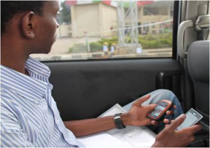
NPI: I think you saw the map created by Digital Matatus? Do you think it is helpful in any way to the matatu industry? If so, how?

To passengers we can assume it is very helpful in knowing your position, and the route to use to get to the next destination. For matatu operators, the TLB regulations do not allow matatus to ply different routes. Most drivers operate like a tethered animal only going as far as the rope permits. They get used to the same roads every day.

A Look at the Social impacts of the Outer Ring Road Project

outering rd construction

Artist’s depiction of the Outer Ring Road Improvement Project

By Simon Kokoyo

If you ever want to get a quick overview of what Nairobi looks like, take a drive along the 13 km stretch of Outer Ring Road.

The road runs along the highest number of concentrated commercial banks in Nairobi as well as densely populated poorer neighbourhoods of the city. It gives direct access to the busy Jomo Kenyatta International Airport, Kariobangi Light Industries and Industrial Area; and acts as link (Thika Highway and Eastern by pass) between two major superhighways coupled with poor road surface. The upgrading of this road is thus likely to have a great number of impacts on its surroundings.

For example, for the last five years at Kairobangi Market, a group of approximately 200 open air traders, mostly women, have been selling vegetables and second clothes close to the road. It is interesting to note that traders operating from Kiamaiko and Kariobangi sides of the road talk to each other easily as the road is very narrow. Weekly Chamas or ‘roundtable banking’ sessions are common since traders get money on a daily basis. Many such traders are scattered along the 13 km stretch that will be upgraded.

In the morning and evening pedestrians will be seen crossing haphazardly and walking close to the road, while matatus stop at undesignated areas and cyclists compete for space with motorists. Accidents are a common occurrence along the road as people rush, in pursuit of reaching work on time.

Communities from both side of the road share many resources such as schools, churches, colleges, markets and even family ties. Observing children and adults crossing at the road junctions can be chilling experience since most motorists drive at high speed, and the city has not put any effort to controlling speeds and designing safe crossings and street design. Currently, there are no footbridges, zebra crossings, bumps or road signs to warn pedestrians and motorists. Workers from Mathare North Area 1 crossing to access Baba Dogo Industries, for example, are left at the mercy of kind motorists who allow them to cross when there should be a proper crossing for these large numbers of people.

Pic2

Women traders will be affected by the Outer Ring Road Project

Now added to this mix is an African Development Bank financed Nairobi Outer Ring Road Improvement Project overseen by the Kenyan Urban Roads Authority (KURA). A notice was issued to businesses operating along the Outer Ring Road corridor to move to pave way for the Nairobi Outer Ring Road Improvement Project. Issues immediately started emerging among open air and informal traders. The key questions of “where shall we go”. This project has created anxiety and uncertainty.

Along Kagundo Road off Outer Ring Road, new businesses areas are slowly emerging as a result of voluntary relocation by traders who have opted to give way for the Nairobi Outer Ring Road Improvement Project. Kariobangi North, Kariobangi South, Umoja Nairobi County markets have always been full. It is expected that these markets will absorb some of the traders. Pressure for business rental spaces has increase in Pipeline Estate, Donholm, Umoja and Kariobangi locations, and prices are likely to go up, making the costs of business more expensive and the traders and residents will also have to make longer trips to access footbridges.

The Nairobi Outer Ring Road Improvement Project promises to make huge changes. The existing road will be transformed into a wide dual carriage with footbridges, road signs, more trees, underpass, flyovers and improved drainage system. The improved road will see current road crossing patterns disrupted, as pedestrians will be expected to use footbridges and designated places for either for walking and cycling.

Pic1

The Outer Ring Road Improvement Project Area (KURA website)

The new road will have ten footbridges. This will either limit or increase interaction between different communities and access to resources depending with how strategically they will be positioned. Building of footbridges does not necessarily motivate people to use them, Thika Highway being a clear example where poor design and inadequate positioning have hindered their utility and attractiveness to pedestrians.

New development or technology like an upgraded road makes sense when it saves lives and brings about efficiency but poor design can cause many adverse impacts. Involving affected communities in the design and identification of appropriate locations will thus be essential to avoid the problems of Thika Highway. The Outer Ring Road cuts across areas known for high levels of crime is certain locations which the design should also try to address.

Appropriate safety features such as low speeds in high-density neighborhoods and near schools (in line with the proposed Traffic (Amendment) Act of 2014) as well as massive safety awareness campaigns targeting motorists and the community located along the road will help reduce accidents and save lives. Regular road users have been used to crossing the road at any point and with no access to footbridges. Making the design process participatory and safety awareness continuous while construction is going on will help bring about desired behavior change.

As the for the cyclists, Nairobi County Government needs to create bike lanes and free and safe parking zones in Central Business District and elsewhere to promote the culture cycling in Nairobi while also ensuring small scale traders have enough space and do not invade bicycle and walking paths. (The Outer Ring Road project includes bike lanes).

Informal and small-scale traders play an important role given the limited number of job opportunities available in Kenya. It is well known that these businesses in the so-called ‘informal sector” produce the bulk of new employment in the city. The Nairobi City County Council should have addressed their worries earlier before the road project, through prior investment in expanding existing markets while also constructing new ones in strategic locations. Currently, anxiety remains among the Project Affected Persons (PAPs) of the Nairobi Outer Ring Road Improvement Project.

Simon Kokoyo grew up in Mathare. He currently works for the Spatial Collective and is a board member of the Reality Tested Youth Programme, a community organization that serves the youth in Huruma, Kaimaiko and Mathare areas. He has a blog about Mathare http://matharevalley.wordpress.com/


Kenya Can Lead in the Open Transit Data Movement for Africa


Collecting Transit Data Nairobi: Courtesy Digital Matatus

Collecting Transit Data Nairobi: Courtesy Digital Matatus

Posted by Jacqueline M. Klopp 

Transportation has become a major focus of concern in Kenya. Congestion, air pollution, traffic crashes, poor air quality and insecure public transit are major problems that undermine the economic growth and well being of cities. This includes the Nairobi Metropolitan Region which some estimate produces 45% of Kenya’s GDP. The government has been responding to these concerns with attempts to regulate the public transit sector and by upgrading road infrastructure and services like rail and introducing bus rapid transit. However, creating systems that manage transit and inform these proposed changes is critical to the success of these efforts. In turn this requires good data, which needs to be shared.

Why open transport data?

  • To be effective policy, projects and planning should be driven by inclusive dialogue, technical expertise and data.

There is a global movement to make transit data open. Most often consultants collect data to input into analysis that informs transportation decisions. Yet they often do not share this data more widely with different government agencies and even across projects by the same ministry. This makes planning more expensive as each project usually has to collect data from scratch or take a lot of time to access data. This reduces efficiency as well as any possibility of independent research and analysis from the universities and think tanks that could help lead to improvements in the project. Further, it is hard for the government to benchmark changes made by the projects if good quality data is not consolidated and shared.

  • Collecting more transport data and opening it up also enables technology innovation that supports better operations and passenger experiences.

Open data allows the creation of phone and web-based applications for passengers and operators. For example, two entrepreneurs in Nairobi have developed trip planner applications- Ma3route and Flashcast Sonar- that give people better information for planning their trips and also provides other key information and a way for passengers to share information among themselves including about traffic conditions. This is also important for people from outside the city who wish to visit and do not know how to get around. Those involved in the tourism sector have been trying to create better information for visitors as well.

  • By creating data and putting it in a standard format like GTFS (General Transit Feed Specification), this allows the use of open source software to develop planning tools. These tools help planners to see how the city operates and plan better as well as gather public input more efficiently through “crowdsourcing” (gathering feedback through text messaging, websites or email).

Besides building infrastructure the government needs to create local systems to manage traffic flows, reduce congestion and make safer conditions for drivers and pedestrians. To do this they need to work with drivers, pedestrians and the rail and matatu sector to manage public transit in a more regularized way. All this requires data and visualization tools that are easy to use.  Rather than spend large sums on hiring foreign consultants the government can encourage and work with local software designers and technologists to develop systems and tools more appropriate to the local context. The universities can help cultivate local experts who can provide technical support for these systems.

How to create open transport data?

The good news is that with cellphone and GPS technology, new, lower cost methods are available to collect critical data on transport. For example, “big data” collected by telecommunications companies can help analyze traffic flows and other dynamics of cities. When the telecommunications company Orange recently released its data for Abidjan in Ivory Coast, IBM researchers were able to develop ways to better plan bus routes for the city. However, sometimes this data is not released for analysis by wider groups of people stifling the prospects of innovation.

Fortunately, teams of people with cellphones can also create useful data by using certain tools or applications. For example, in the Digital Matatu Project, the University of Nairobi with its students mapped out the matatu routes in the city of Nairobi, creating valuable information for citizens, planners and technologists. The map Kibera project created a map of Kibera that is also useful for planning for that community and the Spatial Collective has done the same for Mathare. Before these efforts Kibera and Mathare were not well represented on city maps before.

Who can create data?

 While specialized consultants will continue to collect specific data for various transport projects, their task will be simplified when good quality base data is available. Such basic data can include routes, stops, frequencies of service etc. As we have seen and the Digital Matatu project and other mapping projects prove, data creators do not need to be private consultants who work for the government. They can include government, universities, think tanks, businesses, transport operators, community groups and through crowdsourcing, citizens. Ideally, many of these groups will work together to create and share data.

Kenya is well poised to lead an open transit data movement for Africa.

digitalMatatus launches Nairobi Public Transit Map

By Jacqueline M. Klopp

Yesterday, the Kenya Alliance of Resident Association and the digitalMatatu consortium launched a comprehensive public (matatu) transit map and data base of routes and stops for Nairobi.The government in Nairobi has conducted little planning of public transit, leaving operators and drivers of matatus to shape the system. This means that many routes and stops are not officially designated and, while this allows matatus to be demand responsive and flexible, it also makes them vulnerable to police harassment and violent cartels. These dynamics contribute to the congestion problems in the city, poor conditions for matatu drivers, and inadequate and insecure public transit for this city of 3.5 million people. Collecting data needed for starting to better plan and improve this system is also challenging.

The digitalMatatu consortium consisting of  the Civic Data Design Lab MIT, C4D lab at the University of Nairobi, the Center for Sustainable Urban Development at Columbia University and Groupshot set out to leverage low cost technology to create one of the first comprehensive data sets for Nairobi’s “paratransit” system. Students with handheld devices sought out and road in matatus mapping out stops and routes. What is particularly signifiant about this work is that it demonstrates that transit systems commonly considered too “chaotic” to capture can be amenable to data collection efforts.

Another key  feature of the digitalMatatu work is that the data collected is open and  in a basic standard (GTFS) which allows use of open source software to develop trip planner and other applications for passengers and planners from the data. With the rapid changes in transit in Nairobi it will be critical to develop systems to update and gather more data and host it on an open transport data portal.

The data which contains 130 routes and stops, both designated and non-designated, has already proved its usefulness. Two entrepreneurs Laban Okune and Jeremy Gordon developed useful apps Ma3route and Sonar respectively. In turn, these apps can now help gather other useful data on accidents, congestion and driving via crowdsourcing. Planners have also been asking for the digitalMatatu data.  At the launch of the map developed from the data Permanent Secretary of Transport Muli noted that “mapping of the current transit data provides a basis for proper planning and the Nairobi County government will come up with new PSV routes to help decongest the city and which will be used as a measure for issuing the new operating licences.” County Cabinet Secretary Mr. Ondieki announced that the county would adopt and use the map and data.

More information and the data is all available at digitalmatatus.com.